Brunswick’s parks
Parks
Scroll down to see information about each park.
Boston Knoll
This neighborhood park can be reached by car via Weathervane off of Boston Road or by a walkway off of Berkeley Lane. The park offers several recreational opportunities. A forested walkway connects Boston Knoll to North Park (walkway off of Berkeley Lane), allowing park users to enjoy its walking trails through the beech-maple forests. The City worked with a subdivision developer in designing the park in the late 1970s. This was the first attempt by the City to work directly with a developer to assure the improvements and property met the City’s needs.

Location & information
Location: 107 Weathervane Ln
Acquired:
Acreage:
Public access points: Weathervane via Boston Rd
Park highlights & trails
- trail connector to North Park
Amenities
- parking
- trash receptacle
- picnic tables
- playset
- softball/baseball fields
Bridgeport Park
Bridgeport, a neighborhood park, can be accessed by car via Suffolk Lane or by a walkway off of Portsmouth Drive. This park offers the typical design of a neighborhood park which others have been compared to. It features a mixture of active and passive use. The natural open space provides the opportunity to observe grassland birds — sparrows, bluebirds and hawks.

Location & information
Location: 404 Winchester Lane
Acquired: built in 1995; City accepted land from developer
Acreage: 5.0 acres
Public access points:
- Winchester Lane (driveway/parking area)
- Suffolk Lane (driveway/parking area)
- Portsmouth Drive (walkway)
Park highlights & trails
- wooded areas
- creek
- paved walkways
Amenities
- parking
- dog walking
- trash receptacle
- picnic tables
- playset
- basketball court
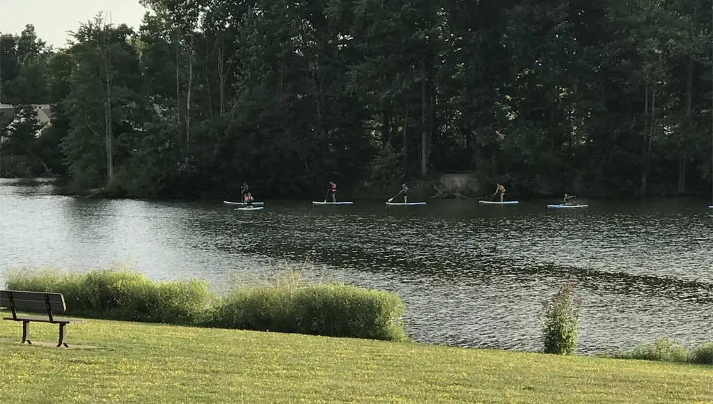
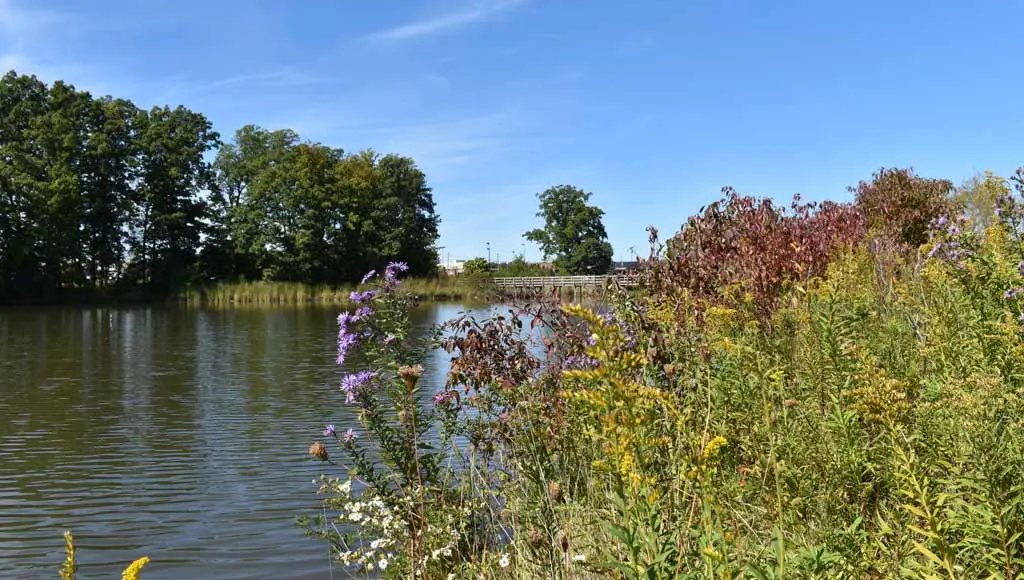
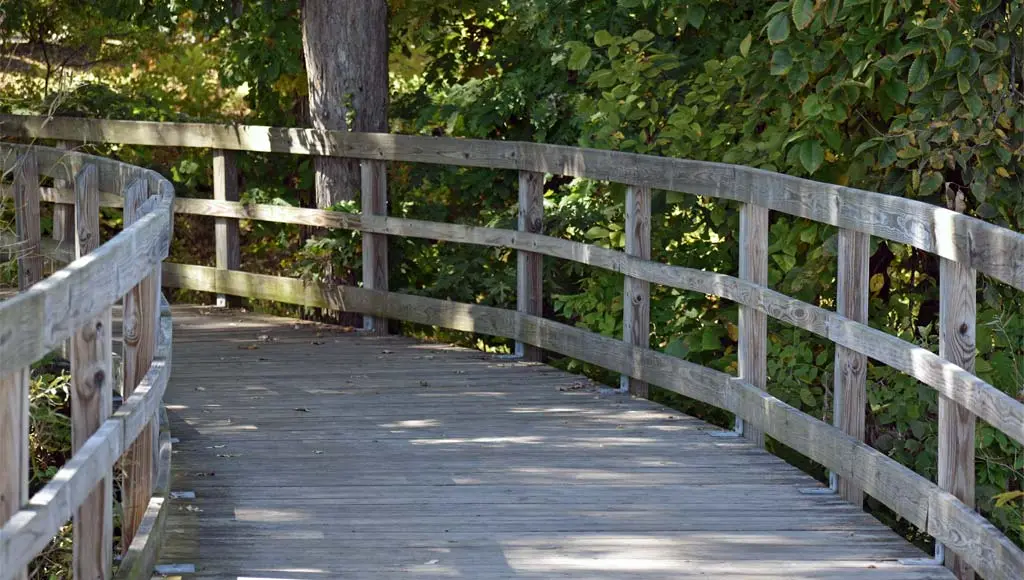
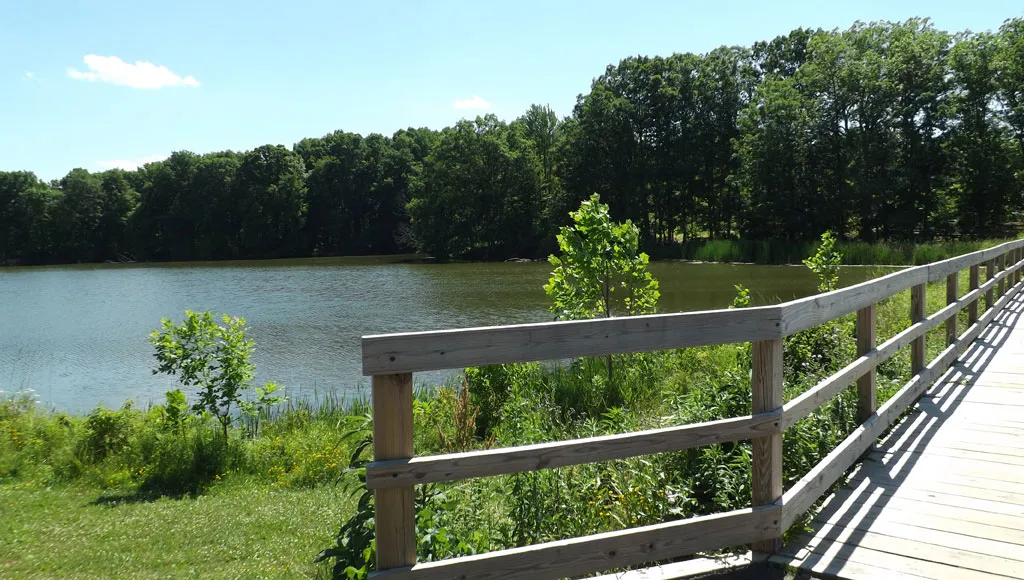
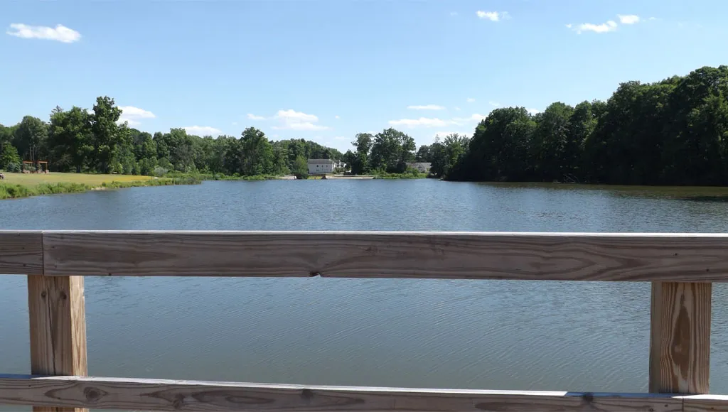
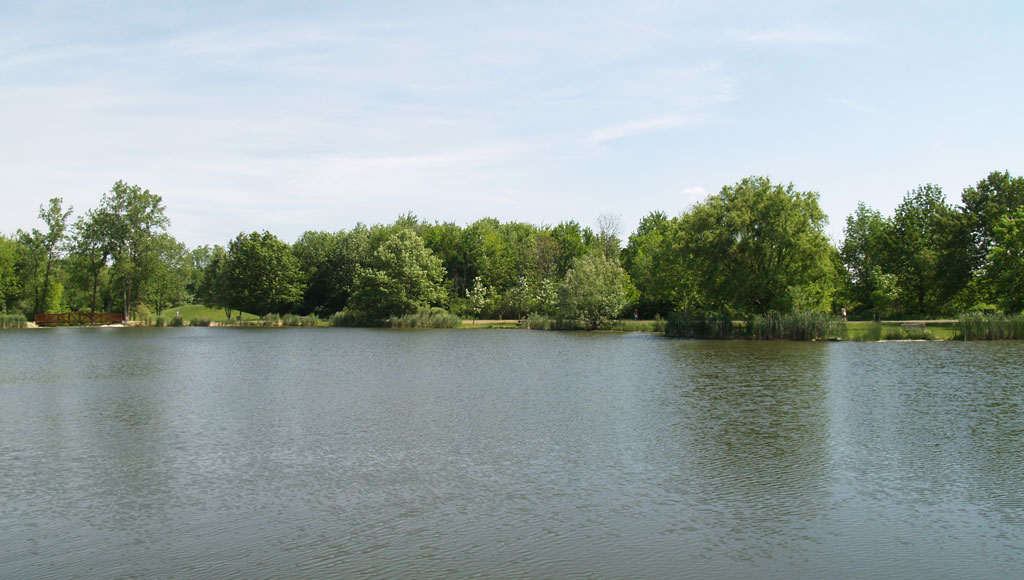
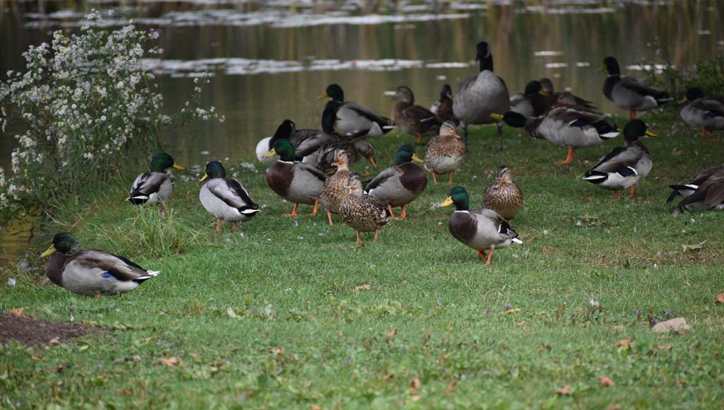
Brunswick Lake Park
Brunswick Lake Park boasts beautiful maple, ash, oak and beech trees and a variety of wild flowers throughout its 79 acres. Visitors to the park can spot ducks, frogs, turtles, deer, mink, squirrels, and of course a variety of birds. The lake itself is over 13 acres and is home to a variety of fish.
A one mile walking trail including two boardwalks encircles the lake, providing residents with easy walking access to the Susan Hambley Nature Center, the nearby Southlake neighborhood, and nearby shopping and dining at Brunswick Town Center.
Location & information
Location: Brunswick Lake Parkway (off Center Road)
Acquired:
Acreage: 79 acres
Public access points:
- Brunswick Town Center
- Nature Center
Park highlights & trails
- 1 mile fitness path, nature center, lake (non-motorized boats permitted on the lake)
- ½ mile nature trail
Amenities
- dog walking
- fishing
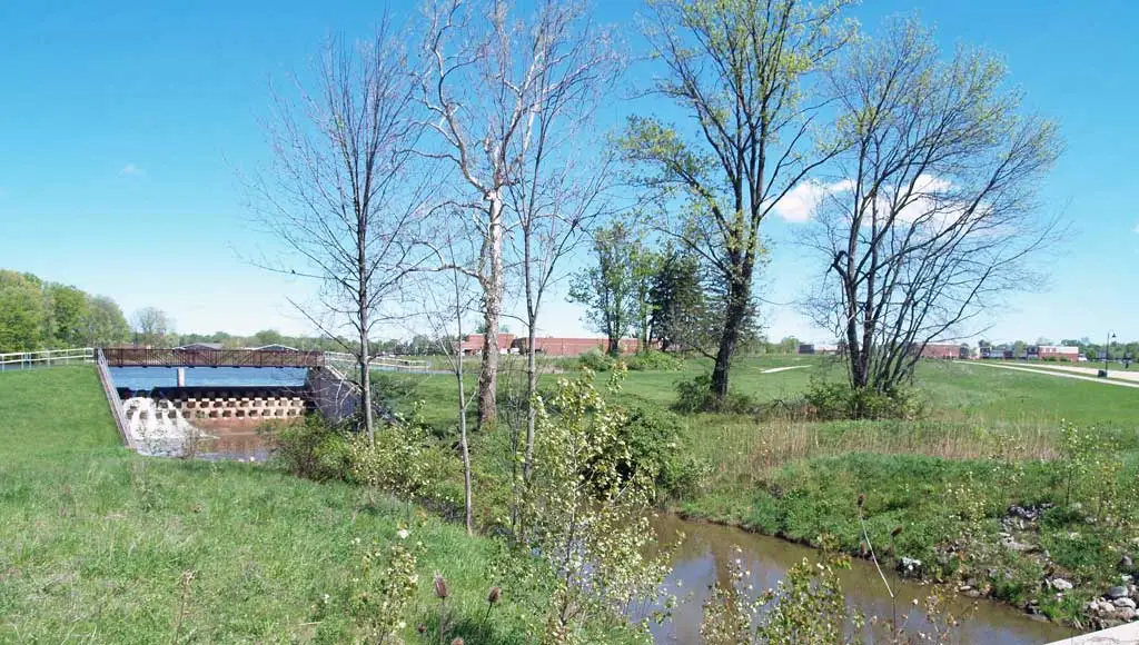
Dog Park
The dog park is a .75 acre off-leash area for dogs.

Location & information
Location: Cross Creek Drive
Acquired: late 1980s; accepted the property from the Cross Creek developer
Acreage: 17.0 acres
Public access points:
- Cross Creek Drive
Park highlights & trails
- natural open space/creek
Amenities
- parking
- trash receptacle
- off leash area
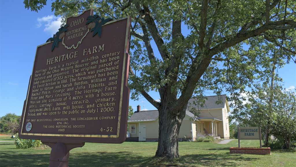
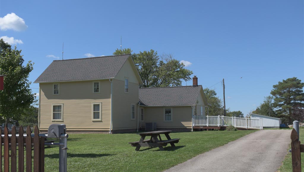
Heritage Farm
A former farm kept to preserve part of the History of the City of Brunswick, Heritage Farm Park is run through a joint effort between the city and the Brunswick Historical Society.
Location & information
Location: 4613 Laurel Rd.
Acquired:
Acreage: 32 acres
More information about Heritage Farm and Museum is available from The Brunswick Area Historical Society.
Public access points:
- Laurel Road (driveway/parking lots)
- surrounding subdivisions (walkways)
Park highlights & trails
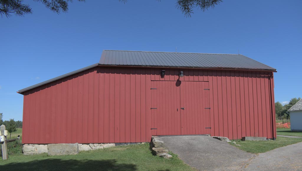
- Historical Farmstead from 1860’s includes home (currently a museum of Brunswick History), restored barn and outbuildings.
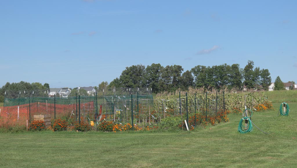
- Park is also the site of our community garden program where residents can rent a garden plot for the summer.
- 1 mile walking trail through tall grass prairie, home to pheasant, meadowlarks, and many other grassland species.
- Farmer’s Market runs on Sundays (early summer through early fall)
Amenities
- parking
- dog walking
- trash receptacle
- picnic tables
- wildlife viewing
- walking/hiking trails
- historic site
More information about Heritage Farm and Museum is available from The Brunswick Area Historical Society.
Heritage Farm
A former farm kept to preserve part of the History of the City of Brunswick, Heritage Farm Park is run through a joint effort between the city and the Brunswick Historical Society.
Location & information
Location: 4613 Laurel Rd.
Acquired:
Acreage: 32 acres
More information about Heritage Farm and Museum is available from The Brunswick Area Historical Society.
Public access points:
- Laurel Road (driveway/parking lots)
- surrounding subdivisions (walkways)
Park highlights & trails
- Historical Farmstead from 1860’s includes home (currently a museum of Brunswick History), restored barn and outbuildings.
- Park is also the site of our community garden program where residents can rent a garden plot for the summer.
- 1 mile walking trail through tall grass prairie, home to pheasant, meadowlarks, and many other grassland species.
- Farmer’s Market runs on Sundays (early summer through early fall)
Amenities
- parking
- dog walking
- trash receptacle
- picnic tables
- wildlife viewing
- walking/hiking trails
- historic site
More information about Heritage Farm and Museum is available from The Brunswick Area Historical Society.
Hopkins Park
Hopkins Park, one of our eight community parks, can be reached by vehicle via Laurel Road or Diana Drive, both of which have parking. A walkway off of Barbara Drive also provides access. This park offers room for active recreation along with some wooded areas for passive use. The second largest Swamp White Oak in Ohio can be found next to the Diana Drive entrance gate. In 1982, the City completed negotiations with the previous owner who also requested the park be named Hopkins. A grant was used to purchase the property.
Location & information
Location: 3089 Laurel Road/1721 Diana Drive
Acquired: purchased via grant
Acreage: 32.00 acres
Public access points:
- Laurel Road (driveway/parking area)
- Diana Drive (driveway/parking area)
- Barbara Drive (walkway)
Park highlights & trails
- second largest Swamp White Oak in Ohio
- natural wooded areas
- paved walkways
Amenities
- parking
- dog walking
- trash receptacle
- pavilion
- picnic tables
- restrooms
- grills
- drinking water
- playset
- basketball court
- soccer field
Huntington Circle
This property is undeveloped open space and is maintained only by mowing twice a year.

Location & information
Location: 1870 Berkshire Drive
Acquired:
Acreage: 4.01 acress
Public access points:
- Berkshire Drive
Park highlights & trails
- property next to Huntington Elementary
- outdoor lab
Amenities
- dog walking
- wildlife viewing
James Park
James Park is the smallest park in Brunswick and can be reached by James Blvd. off of North Carpenter.

Location & information
Location: 3602 James Blvd.
Acquired:
Acreage: 1.58 acres
Public access points:
- James Blvd. (driveway/parking area)
- Chargary Drive (driveway/parking area)
- Charlotte Drive (walkway)
Park highlights & trails
- creek
- open space (playfield)
- paved walkway through park
Amenities
- parking
- dog walking
- trash receptacle
- playset
Mooney Park
Mooney can be found off of Windsor Drive and has parking. The park is open when organized games are being played and features a concession stand.

Location & information
Location: 1980 Windsor Drive
Acquired:
Acreage: 11.34 acres
Public access points:
- Windsor Drive (driveway/parking area)
Park highlights & trails
- hiking/biking trail crosses Sleepy Hollow Road and connects to Plum Creek Park North
Amenities
- parking
- trash receptacle
- restrooms
- softball/baseball fields
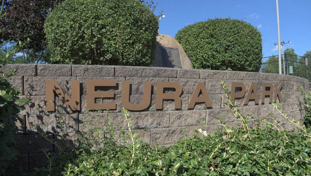
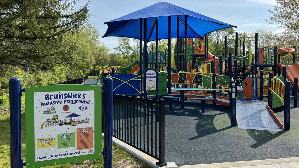
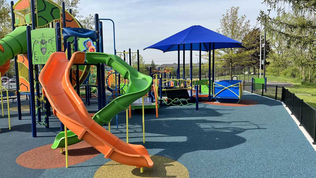
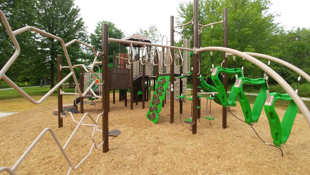
Neura Park
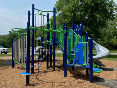
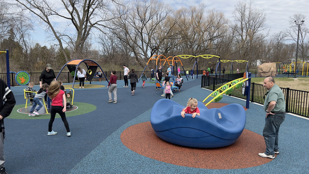
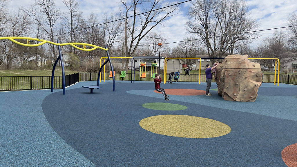
Brunswick’s oldest park offers many facilities for both active and passive uses. An Inclusive Playground was constructed in 2022. Playgrounds such as this ensure physical social inclusion to encourage all children to play together. This community park has a large parking area and some wooded areas along a creek which offer opportunities for wildlife viewing. The park is named after Capt. Theodore P. Neura, who was the first serviceman from Brunswick to die in the Vietnam conflict (Dec. 12, 1963). The park was dedicated in 1975. Initial improvements to the site were by volunteer efforts. Still remaining from this effort is the pavilion. Several grants have been acquired since then to upgrade the park.
Location & information
Location: 4637 Center Road
Acquired: given to the City by a developer in the early 1970s
Acreage: 19.83 acres
Public access points:
- Center Road (driveway/parking area)
Park highlights & trails
- wooded areas
- creek
- paved walkways
Amenities
- parking
- trash receptacle
- picnic tables
- restrooms
- grills
- drinking water
- playset
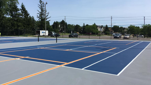
- tennis courts
- softball/baseball fields
Neura Park
Brunswick’s oldest park offers many facilities for both active and passive uses. An Inclusive Playground was constructed in 2022. Playgrounds such as this ensure physical social inclusion to encourage all children to play together. This community park has a large parking area and some wooded areas along a creek which offer opportunities for wildlife viewing. The park is named after Capt. Theodore P. Neura, who was the first serviceman from Brunswick to die in the Vietnam conflict (Dec. 12, 1963). The park was dedicated in 1975. Initial improvements to the site were by volunteer efforts. Still remaining from this effort is the pavilion. Several grants have been acquired since then to upgrade the park.
Location & information
Location: 4637 Center Road
Acquired: given to the City by a developer in the early 1970s
Acreage: 19.83 acres
Public access points:
- Center Road (driveway/parking area)
Park highlights & trails
- wooded areas
- creek
- paved walkways
Amenities
- parking
- trash receptacle
- picnic tables
- restrooms
- grills
- drinking water
- playset
- tennis courts
- softball/baseball fields
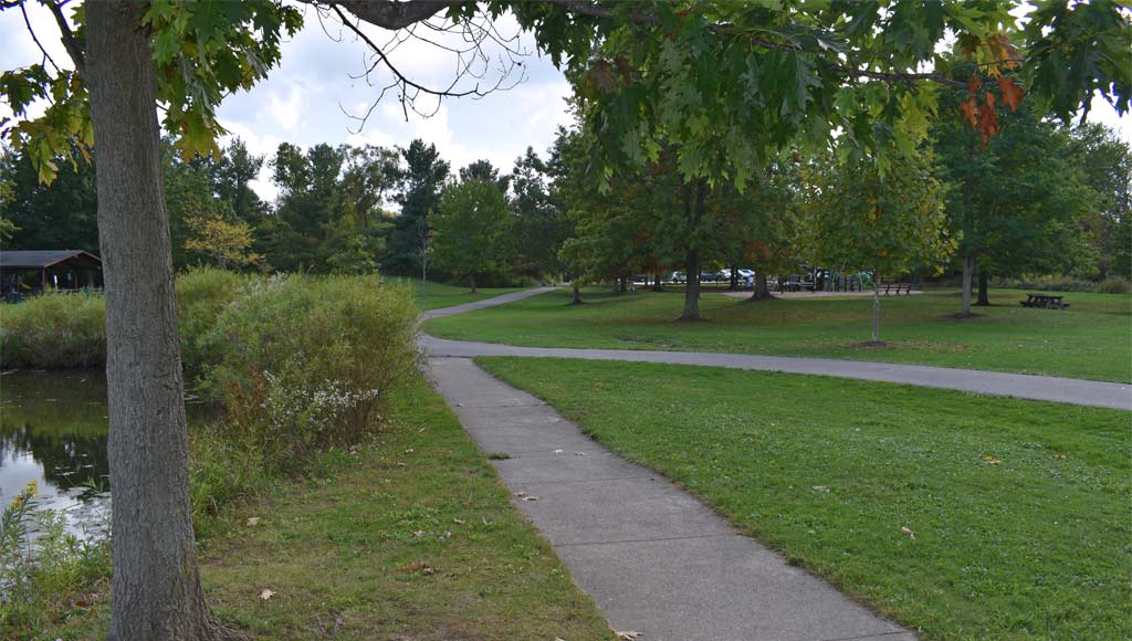
North Park
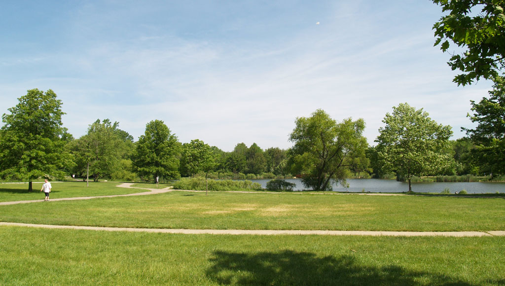
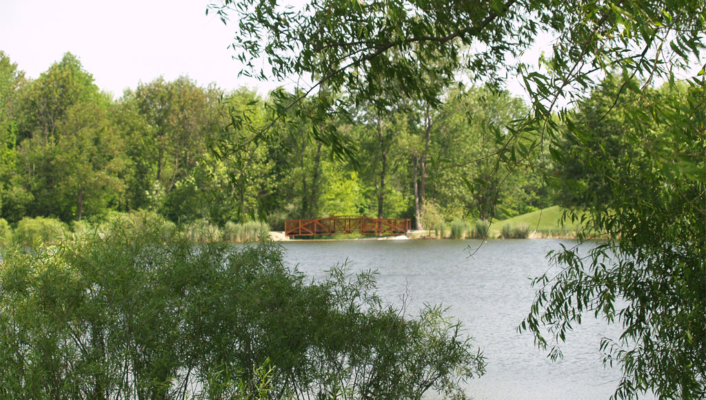
North Park provides a passive atmosphere. The main entrance and parking are accessed off of Grafton Rd. Several walkways are located around the park, offering several subdivisions access to the park. Schools, scouts, families and civic organizations take advantage of its wide variety of year-round activities, programs and opportunities. A five acre lake provides aquatic studies, birds and reptile/amphibian studies and more. Two miles of walking/biking trails are found weaving in and out of the beech-maple forest. A connector trail will take you to Boston Knolls Park. Trails throughout the woods are crushed limestone rock tread and the trail around the lake is paved. The lake is stocked with largemouth bass, bluegill and catfish. Dozens of trout are released for the Fishing Derby held on the first Saturday in May.
In the late 1970s, plans for the park’s initial 42.5 acres were to include baseball and soccer fields with a recreational focus. From a lack of funds to develop the site, the natural features were recognized for their great potential and the focus switched to a “passive” park. In the mid-1980s, fifteen acres were added to the park with a donation from the State of Ohio. Since then, approximately seven acres of forest have been added as a result of negotiations with developers of the Woodlands subdivision and North Park Estates.
Playset photo: Tom Adams
Location & information
Location: 3595 Grafton Road
Acquired:
Acreage: 65.2 acres
Public access points:
- Grafton Road (driveway/parking area)
- Magnolia (small parking area)
- Aster Place (small parking area)
- Berkeley Place (walkway)
- Abington Court (walkway)
Park highlights & trails
- heavily wooded with a beech/maple forest
- wetlands/creeks
- wildlife viewing
- four acre lake with a fishing pier
- fishing
- animal and plant studies
- paved walkway around the lake (1/3 mi.)
- walking/biking trails through the woods (approximately two miles)
- connector trail to Boston Knolls Park
- connector trail to Magnolia
Amenities
- parking
- dog walking
- trash receptacle
- pavilion
- picnic tables
- restrooms
- grills
- drinking water
- wildlife viewing
- playset
- walking/hiking trail
- sledding (winter)
- fishing
- pier

North Park
North Park provides a passive atmosphere. The main entrance and parking are accessed off of Grafton Rd. Several walkways are located around the park, offering several subdivisions access to the park. Schools, scouts, families and civic organizations take advantage of its wide variety of year-round activities, programs and opportunities. A five acre lake provides aquatic studies, birds and reptile/amphibian studies and more. Two miles of walking/biking trails are found weaving in and out of the beech-maple forest. A connector trail will take you to Boston Knolls Park. Trails throughout the woods are crushed limestone rock tread and the trail around the lake is paved. The lake is stocked with largemouth bass, bluegill and catfish. Dozens of trout are released for the Fishing Derby held on the first Saturday in May.
In the late 1970s, plans for the park’s initial 42.5 acres were to include baseball and soccer fields with a recreational focus. From a lack of funds to develop the site, the natural features were recognized for their great potential and the focus switched to a “passive” park. In the mid-1980s, fifteen acres were added to the park with a donation from the State of Ohio. Since then, approximately seven acres of forest have been added as a result of negotiations with developers of the Woodlands subdivision and North Park Estates.
Playset photo: Tom Adams
Location & information
Location: 3595 Grafton Road
Acquired:
Acreage: 65.2 acres
Public access points:
- Grafton Road (driveway/parking area)
- Magnolia (small parking area)
- Aster Place (small parking area)
- Berkeley Place (walkway)
- Abington Court (walkway)
Park highlights & trails
- heavily wooded with a beech/maple forest
- wetlands/creeks
- wildlife viewing
- four acre lake with a fishing pier
- fishing
- animal and plant studies
- paved walkway around the lake (1/3 mi.)
- walking/biking trails through the woods (approximately two miles)
- connector trail to Boston Knolls Park
- connector trail to Magnolia
Amenities
- parking
- dog walking
- trash receptacle
- pavilion
- picnic tables
- restrooms
- grills
- drinking water
- wildlife viewing
- playset
- walking/hiking trail
- sledding (winter)
- fishing
- pier
Pepperwood Park
Pepperwood Park consists of three different parcels of land. The largest parcel is surrounded by Pepperwood Drive, Baywood Drive and Marsh Way, and has several large open areas and a small lake. The lake is stocked with bass and catfish. A three acre wooded area with mature trees is adjacent to the lake. The other two park sites are found off of Pepperwood and Linden Drives and are maintained as open green space for play.

Location & information
Location: 555 Linden Drive/625 Pepperwood Drive
Acquired: late 1970s; deeded to the City by the developer of Pepperwood Subdivision
Acreage: 17.0779 acres
Public access points:
- Linden Drive (walkway)
- Pepperwood Drive/Baywood Drive (two walkways)
- Pepperwood Drive (walkway)
Park highlights & trails
- lake (.5 acres)
- wooded area
- creek
- open space playing field
Amenities
- trash receptacle
- tennis court
- basketball court
- fishing
Pumpkin Ridge Park
This neighborhood park can be reached by a driveway off of Grafton Road or by walkways off of either Salem or Marguerite Way, both of which are off of Grafton. The park consists of mostly open playing areas, except for a small wooded area which offers wildlife viewing.

Location & information
Location: 3062 Grafton Road
Acquired: accepted from developer of the Pumpkin Ridge subdivision
Acreage: 8.29 acres
Public access points:
- Grafton Rd. (driveway/parking area)
- Salem Lane (walkway)
- Marguerite Way (walkway)
Park highlights & trails
- wooded areas
- detention area (grassland)
Amenities
- parking
- trash receptacle
- softball/baseball field
- basketball court
Rolling Hills
Rolling Hills, a neighborhood park, is separated into four parcels, two of which have facilities. The largest parcel, located at the end of Westminster Drive, can be accessed by a driveway and has a parking area. This parcel is mostly wooded, with older growth beech and maple trees along with the associated underbrush. Another parcel, the lake area, consists of a small lake and is accessed by walkways off of either Ambrose Drive or Canterbury Drive.
Originally planned as a “homeowners’ park”, the City was approached in 1986 to accept the property. In 1987 a grant was received to develop the largest parcel along with the lake area and its facilities.

Location & information
Location: 787 Westminster Dr.
Acquired:
Acreage: 30.04 acres
Public access points:
- Ambrose Drive (walkway)
- Canterbury Drive (walkway)
- Westminster Drive (driveway/parking area)
- Angela Lane (walkway)
Park highlights & trails
- old growth trees
- park surrounded by mostly forest
- lake (.25 acre)
- walking path around lake
Amenities
- parking
- dog walking
- walking/hiking trail
- fishing
- tennis court
- playset
Shenandoah Park
Shenandoah, our newest neighborhood park, has both active and passive use. It can be reached by a driveway off of Roanoke Drive via Miner Drive, or by a walkway off of New Market Trail. The park is adjacent to natural areas which attract a variety of birds.

Location & information
Location: 4036 Roanoke Drive
Acquired: turned over to the City in 1999 by the developer of Shenandoah subdivision
Acreage: 7.4 acres
Public access points:
- Roanoke Drive (driveway/parking area)
- New Market Trail (walkway)
Park highlights & trails
- open green space
Amenities
- parking
- dog walking
- trash receptacle
- basketball court
- playset
Venus Park
Venus Park, a neighborhood park, can be accessed off of Venus Drive via Starview Drive/Grafton Road, or by three walkways. A creek divides the park in two but it is connected by a foot bridge.

Location & information
Location: 3901 Venus Drive
Acquired: donated to the City by a developer in the mid-1970s
Acreage: 9.06 acres
Public access points:
- Venus Drive (driveway/parking area)
- Crestway Oval (walkway)
- Claythorne Place (walkway)
- Magnolia Drive (walkway)
Park highlights & trails
- creek divides park
- wildlife viewing
- small wooded areas
- open space
- paved walkways through park
Amenities
- parking
- dog walking
- playset
- basketball court